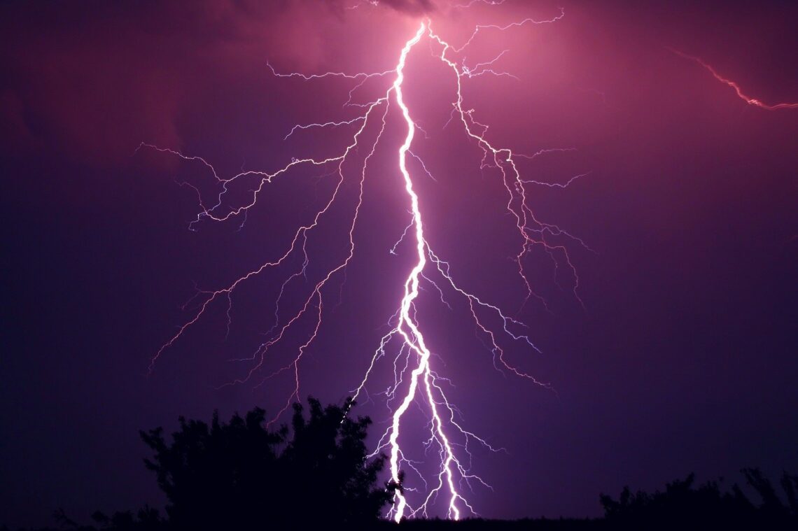
YILDIRIM VE ŞiMŞEK
Yıldırım ve Şimşek bir gün bara girmiş,…
Aşağıdaki linklerde Yıldırım ve Şimşeğe dair bilgiler bulabilirsiniz, bazı zamanlar linklerde bozulmalar olduğu için yazılarıda kendi yazımın sonuna yapıştırdım oradanda bakılabilir.
Yıldırım ve Şimşek oluşumu ile ilgili hala tam aydınlatılamamış olduğu bir gerçek, özetle anlatılan yük farkının bulut içi hareketlerle oluştuğu. Diğer ilave görüş kozmik ışınlarında bunda rolu alabileceği.
Yük farkı bulutlarda oluşuyorsa yine kendi aralarında yükü dengelemesi beklenir, Yer ile bulutlar arasındaki büyük yük farkına tatmin edici bir cevabı olamaz. Kozmik ışınlar etkiliyorsa Lake Maracaibo gibi Dünyanın bazı özel noktalarında oluşan yoğun yıldırımlara nasıl bir açıklama getirebilir. Her iki seçeneğinde ana neden olması imkansız.
Buharlaşma esnasında iyonlaşma gerçekleşiyorsa atmosferle yer arasında sürekli yük farkını besleyebilir. Buna neden olan sulardaki eriyik elementler veya karada suyun temas ettiği diğer elementler, hatta yer ile atmosfer arasında gaz döngüsü sırasında iyonlaşma. Bir ya da daha fazla kaynaktan beslenebilir.
Bulgular sonucu şayet uygun ise farklı türden enerji depolama sistemleride geliştirilebilir.
Linklerde göreceğiniz Çizimlerde gösterilen bulutlarda artı ve eksi yükler aynı bulut üzerinde gösteriliyor bu gerçekte olamaz. Bu türden ölçümler yapılmış ise aralarında fark edilemeyen bir boşluk vardır, temas ettikleri anda aralarında yük farkı kalmaz.
Günlük yaşamımızda temas ettiğimiz kapı kolları, tokalaşma, trabzanlara temas, musluk açma kapama. Kısaca her nereye dokunuyorsak yük farkı varsa hemen giderilir, yük farkları küçük olduğundan bu çoğunlukla fark edilmeden gerçekleşir, nadiren elektrik şokuna maruz kalırız.
Bulutlarda aynı şekilde temas anında yük farkı ortadan kalkar, bir sonraki bulut ile temas ard arda dizilmiş domino taşlarının düşüşü gibi devam eder, ancak bu temaslardan sonra ayrılan bulut parçaları başka bulutlarla temas ederse onlarla yükü dengeleyecek , bunun sonucu daha önce temas ettiği bulutlarla tekrar yük farkı oluşma ihtimali ortaya çıkar. Yük farkının büyüklüğüne göre şimşekler bazı zamanlar görülür.
Sonu gelmeyen sandalye kapma oyunu gibi, oyunun devam etmesi için yük farkını artıracak sürekli bir besleme mekanizması olmalı.

LİNKLER:
Türkçe>>https://mgm.gov.tr/genel/sss.aspx?s=simsekyildirim
İngilizce>>https://www.nssl.noaa.gov/education/svrwx101/lightning/
İngilizce>>https://www.nssl.noaa.gov/education/svrwx101/lightning/types/
İngilizce>>https://scijinks.gov/lightning/
İngilizce>>http://www.planet-science.com/categories/over-11s/natural-world/2012/06/what-causes-lightning.aspx
İngilizce>>https://physicsworld.com/a/cosmic-rays-illuminate-the-electric-fields-that-cause-lightning/
İngilizce>>https://cosmosmagazine.com/science/physics/cosmic-rays-reveal-thunderstorm-secrets/
İngilizce>>https://www.newscientist.com/definition/lightning/
İngilizce>>https://www.sciencelearn.org.nz/resources/239-lightning-explained
İngilizce>>https://www.scientificamerican.com/article/experts-do-cosmic-rays-cause-lightning/
İngilizce>>https://www.nationalgeographic.com/environment/article/lightning
İngilizce>>https://geology.com/articles/lightning-map.shtml
İngilizce>>https://eos.org/science-updates/understanding-high-energy-physics-in-earths-atmosphere
İngilizce>>https://lightningmaster.com/the-worst-lightning-strikes-ever-recorded/
https://mgm.gov.tr/genel/sss.aspx?s=simsekyildirim
Şimşek ve YıldırımMitolojide, şimşek ve yıldırımdan doğaüstü varlıkların atmosferik patlaması: tanrıların büyük silahı olarak korkulmuştur. Eski Yunanlılar şimşeğin/yıldırımın Zeus tarafından fırlatılan mucizevi ışık olduğuna inanırlar ve korkarlardı. Vikingler için şimşek, Thor’un at arabasını bulutlara doğru sürerken, çekicini örsüne vurmasıyla çıkan parlama ve gürültüydü. Uzak Doğu’da Buda’nın ilk heykellerinde her yönde uzanan oklarla şimşek/yıldırım figürleri taşıdığı görülmektedir. Kuzey Amerika’daki Kızıldereli kabileleri de şimşeğin, kanat çırptıkça gök gürültüsü meydana getiren mistik bir kuşun parlayan tüyleri olduğuna inanırlardı. Günümüzde, şimşek ve yıldırımı açıklamak için, sezgisel kavramların yer aldığı mistik tekniklerin yerine deneysel prosedürleri içeren bilimsel teknikler kullanılmaktadır. Her yıl, yıldırım birçok insanın ölmesine, yaralanmasına, ve büyük miktarlarda maddi hasara neden olmaktadır. Yıldırım kazazedeleriyle ilgili bilgilerin sistematik derlemesi mevcut değilse, yıldırım sonucu ölüm ve yaralanmalara ait doğru bir istatistik elde etmek çok güçtür. Yıldırım çarpmasındaki geçmişteki bir çok durum kalp hasarlarını göstermektedir. Ölümle sonuçlanan yıldırım kazalarında akciğerde şişme ve beyin hasarı da gözlenmiştir. Araştırma yapılan birçok kazazede de, bilinç kaybı, bellek kaybı, felç ve yanma rapor edilmiştir. Binalarda, haberleşme sistemlerinde, güç hatları ve elektrik sistemlerinde büyük miktarlarda maddi hasarın yanında, çiftlik hayvanları ve diğer hayvanlarda yaralanma ve ölümler, binlerce çalılık ve orman yangını da yıldırımın sonuçlarındandır. Bir Fırtınanın KarakteristikleriŞimşek / YıldırımBir bulut içerisinde hidrometeorlar olarak adlandırılan parçacıklar gelişir ve etkileşime girer, çarpışma sayesinde de yüklenir. Daha büyük parçacıkların daha fazla negatif yük kazanma, daha küçük parçacıkların ise daha fazla pozitif yük kazanma eğilimde oldukları düşünülmektedir. Bu parçacıklar, bulutun yukarı bölümünün tamamen pozitif yük kazanması ve bulutun aşağı kesimlerinin negatif olarak yüklenmesine kadar, dikey hareketler ve yer çekiminin etkisiyle ayrılma eğilimindedir. Bu yük ayrılması, hem bulut içerisinde hem de bulut ile yer arasında çok büyük bir elektrik potansiyeli oluşturur. Bu potansiyel milyon voltlar seviyesinde olabilir ve sonunda havadaki elektriksel direnç bozulur ve parlama (şimşek çakması) başlar. Yani şimşek orajın negatif ve pozitif bölgelerindeki elektriksel boşalmadır. Bir şimşek çakması, ortalama dört çakma serisinden oluşmaktadır. Her şimşek çakmasının boyut ve süresi değişiktir, ancak tipik olarak ortalama 30 mikrosaniyedir. Her çakma için ortalama en yüksek güç 1012 watt’dır. Gök gürültüsüGök gürültüsü, elektriksel boşalma ile, 20.000 °C (Güneş yüzey sıcaklığının üç katı) ye varan sıcaklık ile atmosferin ısıtılması sonucu ışık (parlama) kanalları boyunca oluşmaktadır. Bu bir şok dalgası üreten çevredeki açık havayı sıkıştırır, ardından da şimşek kanallarından dışarı doğru yayılırken akustik dalgaya dönüşür. Aslında şimşek (parlama) ile gök gürültüsü aynı zamanda oluşmasına rağmen, ışık 186.000 mil/sn hızla ulaşır ki bu ses hızının hemen hemen bir milyon katıdır. Böylece parlama, eğer bulut tarafından gizlenmemişse işitilen gök gürültüsünden önce görülür. Şimşeğin görülmesi ile gök gürültüsünün duyulması arasında geçen sürenin (sn.) 5’e bölünmesi ile şimşek çakmasının olduğu yere olan uzaklık (deniz mili) tahmin edilebilir. Bulutlar ve yağmurNemle yüklü sıcak hava ısındığında yükselmeye başlar. Bu sıcak-nemli hava akımı veya kabarcıklarının atmosferde yükselmesiyle, çevredeki havanın basıncı ve sıcaklığı azalır. Bu hava kabarcıkları genleşir ve sonunda bulut oluşturmak için yoğunlaşan nemin soğumasına neden olur. Bulut daha fazla soğudukça daha fazla nem yoğuşması olur ve su damlacıkları bulut gelişimini sağlar. Bu damlacıklar, bulut içerisindeki hava akımlarının, bunları taşıyamayacak büyüklük ve ağırlığa ulaşıncaya kadar birleşirler. Sonunda taşınamayacak büyüklüğe ulaşan bu su damlacıkları yağmur olarak düşer. DoluCb (Kümülonimbus ) bulutları içerisindeki hava akımları çok şiddetli olabilmektedir. Hatta şimşek oluşmadığı zamanda, buz paletleri su damlacıklarının birleşmesiyle gelişebilir. Dikey faaliyetler çok güçlü olduğunda, gelişen buz paletleri (parçacıkları) daha da büyüyebilmek için uzun süre asılı kalabilirler. Sonunda bu hava akımları içerisinde taşınamayacak bir büyüklüğe erişir ve “dolu” olarak düşmeye başlar. Kayıtlarda 140 mm.’lik bir dolu tanesi olmasına rağmen çapları ortalama 5-10 mm. Dir. En Yaygın Şimşek TipleriBulut-Yer arasında (Yıldırım)En tehlikeli ve hasar verici olan şimşek türüdür. En yaygın tip olmamasına rağmen, en iyi anlaşılan tiptir. Çoğu çakma daha düşük yük merkezine yakın oluşur ve yeryüzüne negatif yük dağıtır. Buna rağmen çakmaların kayda değer bir azınlığı yeryüzüne pozitif yük taşır. Bu pozitif çakmalar sıklıkla bir orajın dağılma aşamasında oluşur. Pozitif çakmalar aynı zamanda kış ayları boyunca toplam yer boşalmalarının (yıldırım) daha yüksek bir yüzdesini oluşturur. Bulut içi şimşekEn yaygın yük boşalma tipidir. Bu tip, aynı bulut içerisinde zıt yük merkezleri arasında oluşur. Genellikle bu işlem bulut içinde oluşur ve bulutun dışından bakıldığında titreşen parlaklığın bir yayılımı olarak görülür. Bunun yanında, çakma bulut sınırlarının dışına çıkabilir ve bulut-yer arası çakmaya (yıldırım) benzer birkaç millik parlak bir ışık kanalı görülebilir. Bulut-Yer ve bulut içi çakmaların oranı orajdan oraja önemli ölçüde değişiklik gösterebilir. En büyük dikey gelişime sahip fırtınalar, genellikle sadece bulut içi çakmayı meydana getirir. Kimileri, değişkenliğin yüksek enlemlerde oluşan bulut-yer arası çakmaların daha büyük bir yüzdeyle enleme bağlı olduğunu belirtmişlerdir. Diğerleri ise bulut tepe yüksekliğinin değişkenlikte daha önemli olduğunu belirtmişlerdir. Yük boşalmasının niçin bulut içerisinde kaldığı ya da yere ulaştığı konusundaki detaylar anlaşılamamıştır. Belki de bir çakma, bulutun aşağı kısımlarındaki elektik alan gradyantı, aşağı doğru olan gradyantdan daha kuvvetli olduğunda yeryüzüne doğru yayılmaktadır. Yeryüzü üzerindeki bulut yüksekliğine ve bulut ile yeryüzü arasındaki elektrik alanı gücüne bağlı olarak yük boşalması, bulut içerisinde kalır veya yeryüzü ile direk temas olur. Eğer bulutun aşağı kesimlerindeki elektrik alanı yüksekse buluttan yere doğru bir çakma oluşabilir. Bulutlar arası şimşekİki farklı bulutun yük merkezleri arasında oluşur. Bu durumda bulutlar ile açık hava arasında yük boşalması ile bir köprü oluşur. Diğer Şimşek TipleriDeğişik tip ve formda çok sayıda şimşek isim ve tanımlamaları vardır. Kimileri alt kategorilere ayrılırken, diğerleri optik ilüzyonlardan, görünümlerden veya söylentilerden ortaya çıkabilmektedir. Bazı popüler şimşek terimleri şunlardır: yumak şimşek, ısı şimşeği, boncuk şimşek, çarşaf şimşek, kara şimşek, şerit (kurdele şimşek), renkli şimşek, düz şimşek, kıvrılan şimşek, buluttan havaya olan şimşek, stratosferik şimşek, kızıl cinler, mavi jetler ve cinler … Şimşek Boşalma İşleminin TanımlanmasıKuvvetli elektrik alanlarına sahip bölgelerdeki havanın bozulmasıyla, bir dalga düşey olarak yer yüzüne doğru yayılır. Bu dalga (akım) her biri yaklaşık 50 m. Olan farklı adımlarla hareket eder ve bu adımlı lider olarak adlandırılır. Bu lider gelişerek kanal boyunca yük depolayan iyonize bir yol yaratır ve liderin yeryüzüne ulaşmasıyla liderin sonu ile yeryüzü arasında çok büyük bir potansiyel fark yaratılır. Tipik olarak, ilk dalga (akım) yeryüzü tarafından gönderilir ve alçalan lideri yere ulaşmadan hemen önce durdurur. Hemen bir bağlantı yolu elde edilir, dönen çarpma ışık hızına yakın bir hızda, henüz iyonize edilmiş yola fırlatılır. Bu geri dönen çakma çok parlak ışık ve gök gürültüsü şeklinde, çok büyük bir enerji olarak serbest bırakılır. Bazen oraj yeryüzü üzerindeki radyo anteni gibi yüksek bir nesne üzerinde gelişirse, bu nesnelerin uç kısmından buluta doğru bir dalga gönderilebilir. Bu “yerden-buluta” çakma genellikle net pozitif yükün yeryüzüne transfer edilmesidir.
GüvenlikŞimşek çakması esnasında en yaygın tehlikeli 6 aktivite sırasıyla şunlardır:
Eğer şimşek çakması esnasında açık alanda iseniz saçlarınız dikelir. Bu durumda hemen en yakın binanın içine girin. Eğer sığınacak kapalı bir alan yoksa, mümkün olan en alçak yerde çömelin. KESİNLİKLE YERE UZANMAYINIZ. Kazazede Tedavisi
|
| https://www.nssl.noaa.gov/education/svrwx101/lightning/ |
| Lightning basics
What is lightning?
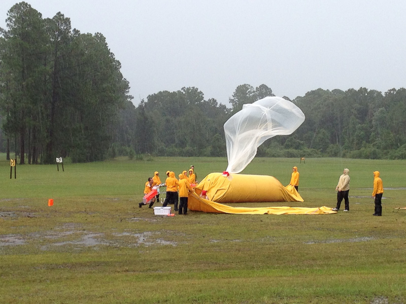
What we do: NSSL researchers use a 3-D cloud model to investigate the full life-cycle of thunderstorms. The model has shown how graupel or other droplets could help form regions of lower charge within the storm. NSSL team launches an instrumented weather balloon to study lightning in northern Florida. [+ NSSL researchers were pioneers in the science of launching instrumented weather balloons into thunderstorms. This capability allowed NSSL to collect weather data in the vicinity of tornadoes and drylines, and all the way up through a thunderstorm, gathering critically needed observations in the near-storm environment of thunderstorms. In addition, these mobile labs and ballooning systems provided the first vertical profiles of electric fields inside a thunderstorm leading to a new conceptual model of electrical structures within convective storms. One way researchers test their theories is by making measurements of severe thunderstorms in the field and later analyzing the results. Large-scale field experiments involving many instruments with a primary focus on atmospheric electricity include the Deep Convective Clouds and Chemistry experiment (DC3), the MCS Electrification and Polarimetric Radar Study, the Severe Thunderstorm Electrification and Precipitation Study and the Thunderstorm Electrification and Lightning EXperiment. |
| LIGHTNING TYPES >>> https://www.nssl.noaa.gov/education/svrwx101/lightning/types/ |
| LIGHTNING TYPES
Most lightning starts inside a thunderstorm and travels through the cloud. It can then stay within the cloud or continue to travel through the open air and eventually to ground. There are roughly 5 to 10 times as many flashes that remain in the cloud as there are flashes which travel to the ground, but individual storms may have more or fewer flashes reaching ground. Lightning can strike where it’s not raining, or even before rain reaches the ground! Cloud-to-Ground FlashesThere are two ways that flashes can strike ground: naturally downward (those that occur because of normal electrification in the environment), and artificially initiated or triggered upward. Artificially initiated lightning is associated with things like very tall structures, rockets and towers. Triggered lightning starts at the “ground,” which in this case may mean the top of a tower, and travels upward into the cloud, while “natural” lightning starts in the cloud and travels to ground. Upward triggered lightning usually occurs in response to a natural lightning flash, but on rare occasions can be “self-triggered”—usually in winter storms with strong winds. Lightning can also be triggered by aircraft flying through strong electric fields. If the plane is below the cloud, then a CG flash could result. In the most common type of cloud-to-ground lightning (CG), a channel of negative charge, called a stepped leader, will zigzag downward in roughly 50-yard segments in a forked pattern. This stepped leader is invisible to the human eye, and shoots to the ground in less time than it takes to blink. As it nears the ground, the negatively charged stepped leader causes streamer channels of positive charge to reach upward, normally from taller objects in the area, such as a tree, house, or telephone pole. When the oppositely-charged leader and streamer connect, a powerful electrical current begins flowing. This return stroke current of bright luminosity travels about 60,000 miles per second back towards the cloud. A negative CG flash consists of one or perhaps as many as 20 return strokes. We see lightning flicker when the process rapidly repeats itself several times along the same path. The actual diameter of the lightning channel current is one to two inches, surrounded by a region of charged particles. The more common cloud-to-ground flash has a negative stepped leader that travels downward through the cloud, followed by an upward traveling return stroke. The net effect of this flash is to lower negative charge from the cloud to the ground so it is commonly referred to as a negative CG (or -CG). Less commonly, a downward traveling positive leader followed by an upward return stroke will lower positive charge to earth, referred to as a positive CG (or +CG). +CG flashes typically have only a single return stroke, and they are more likely than -CGs to have a sustained current flow. Some storms produce more positive than negative CGs because of the charge distribution in the storms, but+CG dominated storms are not as common. Storms which produce mostly negative CGs tend to produce CGs earlier in the storm lifecycle and produce significantly more CGs than similar storms which instead produce mostly positive CGs. A “bolt from the blue” is a CG which starts inside a cloud, goes out the side of the storm, then travels horizontally away from the cloud before going to ground. A bolt from the blue can strike ground at a spot with “blue sky” above it. So even a storm that is 6 miles away can be dangerous. Cloud FlashesThere are many flashes which do not reach ground. Most of these remain within the cloud and are called intra-cloud (IC) lightning flashes. Cloud flashes sometimes have visible channels that extend out into the air around the storm (cloud-to-air or CA), but do not strike the ground. The term sheet lightning is used to describe an IC flash embedded within a cloud that lights up as a sheet of luminosity during the flash. Other Lightning-Related TermsA related term, heat lightning, is any lightning (IC or CG) or lightning-induced illumination that is too far away for the thunder to be heard. It may have reddish (“heat”) color, like sunsets, because of scattering of blue light. There are a lot of misconceptions about heat lightning, but it’s no different than regular lightning. Lightning can also travel from one cloud to another, or cloud-to-cloud (CC). Spider lightning refers to long, horizontally traveling flashes often seen on the underside of stratiform clouds. Spider lightning is often linked to +CG flashes. Transient Luminous EventsLarge thunderstorms are capable of producing other kinds of electrical phenomena called transient luminous events (TLEs) that occur high in the atmosphere. They are rarely observed visually and not well understood. The most common TLEs include red sprites, blue jets, and elves. Sprites can appear directly above an active thunderstorm as a large but weak discharge. They usually happen at the same time as powerful positive CG lightning strokes. They can extend up to 60 miles from the cloud top. Sprites are mostly red and usually last no more than a few seconds, and their shapes are described as resembling jellyfish, carrots, or columns. Because sprites are not very bright, they can only be seen at night. They are rarely seen with the human eye, so they are most often imaged with highly sensitive cameras. Fun fact: Aircraft pilots occasionally reported seeing lightning above storms for many years before researchers documented sprites and other TLEs with sensitive video cameras. Blue jets and gigantic jets emerge from the top of the thundercloud, but are not directly associated with cloud-to-ground lightning. They extend up in narrow cones fanning out and disappearing at heights of 25-35 miles. Gigantic jets go even higher to the ionosphere. Blue jets last a fraction of a second and have been witnessed by pilots. Elves are rapidly expanding disk-shaped regions of glowing that can be up to 300 miles across. They last less than a thousandth of a second, and occur above areas of active cloud to ground lightning. Elves result when an energetic electromagnetic pulse extends up into the ionosphere. Elves were discovered in 1992 by a low-light video camera on the Space Shuttle, and are now known to be associated with terrestrial gamma ray flashes (TGFs). TGFs were discovered in the 2000s by satellites designed to detect cosmic gamma rays, but it was found that some signals were coming from thunderstorms on earth! TGF appear to originate where strong electric fields exist in a deep region to act as a particle accelerator that is seeded by cosmic ray particles. This can also produce beams of relativistic electrons. Normal lightning also produces x-rays that can be detected at the ground. |
| https://scijinks.gov/lightning/ |
What causes lightning and thunder?
Lightning!Zap! You just touched a metal doorknob after shuffling your rubber-soled feet across the carpet. Yipes! You’ve been struck by lightning! Well, not really, but it’s the same idea. Your rubber-soled shoes picked up stray electrons from the carpet. Those electrons built up on your shoes giving them a static charge. (Static means not moving.) Static charges are always “looking” for the first opportunity to “escape,” or discharge. Your contact with a metal doorknob—or car handle or anything that conducts electricity—presents that opportunity and the excess electrons jump at the chance. What causes lightning?So, do thunderclouds have rubber shoes? Not exactly, but there is a lot of shuffling going on inside the cloud.
Lightning begins as static charges in a rain cloud. Winds inside the cloud are very turbulent. Water droplets in the bottom part of the cloud are caught in the updrafts and lifted to great heights where the much colder atmosphere freezes them. Meanwhile, downdrafts in the cloud push ice and hail down from the top of the cloud. Where the ice going down meets the water coming up, electrons are stripped off. It’s a little more complicated than that, but what results is a cloud with a negatively charged bottom and a positively charged top. These electrical fields become incredibly strong, with the atmosphere acting as an insulator between them in the cloud. When the strength of the charge overpowers the insulating properties of the atmosphere, Z-Z-Z-ZAP! Lightning happens. How does the lightning “know” where to discharge—or strike?The electric field “looks” for a doorknob. Sort of. It looks for the closest and easiest path to release its charge. Often lightning occurs between clouds or inside a cloud. But the lightning we usually care about most is the lightning that goes from clouds to ground—because that’s us! As the storm moves over the ground, the strong negative charge in the cloud attracts positive charges in the ground. These positive charges move up into the tallest objects like trees, telephone poles, and houses. A “stepped leader” of negative charge descends from the cloud seeking out a path toward the ground. Although this phase of a lightning strike is too rapid for human eyes, this slow-motion video shows it happening. As the negative charge gets close to the ground, a positive charge, called a streamer, reaches up to meet the negative charge. The channels connect and we see the lightning stroke. We may see several strokes using the same path, giving the lightning bolt a flickering appearance, before the electrical discharge is complete. What causes thunder?In a fraction of a second, lightning heats the air around it to incredible temperatures—as hot as 54,000 °F (30,000 °C). That’s five times hotter than the surface of the Sun! The heated air expands explosively, creating a shockwave as the surrounding air is rapidly compressed. The air then contracts rapidly as it cools. This creates an initial CRACK sound, followed by rumbles as the column of air continues to vibrate. If we are watching the sky, we see the lightning before we hear the thunder. That is because light travels much faster than sound waves. We can estimate the distance of the lightning by counting how many seconds it takes until we hear the thunder. It takes approximately 5 seconds for the sound to travel 1 mile. If the thunder follows the lightning almost instantly, you know the lightning is too close for comfort! What does lightning look like from space?Lightning is an important part of weather forecasting. The Geostationary Lightning Mapper instrument on the GOES-R series satellites can detect lightning activity over nearly the whole Western Hemisphere. Scientists use data from GOES-R series satellites, along with data from the Lightning Imaging Sensor on NASA’s Tropical Rainfall Measuring Mission satellite, to study lightning. This complete picture of lightning at any given time will improve “now-casting” of dangerous thunderstorms, tornadoes, hail, and flash floods. |
| http://www.planet-science.com/categories/over-11s/natural-world/2012/06/what-causes-lightning.aspx |
What causes lightning?Lightning strikes!Have you ever got a static electricity shock? Or seen sparks when you take off your jumper? When lightning is made the same thing happens, but on a much bigger scale. How does lightning form? Lightning is an electric current. To make this electric current, first you need a cloud. When the ground is hot, it heats the air above it. This warm air rises. As the air rises, water vapour cools and forms a cloud. When air continues to rise, the cloud gets bigger and bigger. In the tops of the clouds, temperature is below freezing and the water vapour turns into ice. Now, the cloud becomes a thundercloud. Lots of small bits of ice bump into each other as they move around. All these collisions cause a build up of electrical charge. Eventually, the whole cloud fills up with electrical charges. Lighter, positively charged particles form at the top of the cloud. Heavier, negatively charged particles sink to the bottom of the cloud. When the positive and negative charges grow large enough, a giant spark – lightning – occurs between the two charges within the cloud. This is like a static electricity sparks you see, but much bigger. Most lightning happens inside a cloud, but sometimes it happens between the cloud and the ground. A build up of positive charge builds up on the ground beneath the cloud, attracted to the negative charge in the bottom of the cloud. The ground’s positive charge concentrates around anything that sticks up – trees, lightning conductors, even people! The positive charge from the ground connects with the negative charge from the clouds and a spark of lightning strikes. |
| https://physicsworld.com/a/cosmic-rays-illuminate-the-electric-fields-that-cause-lightning/ |
Cosmic rays illuminate the electric fields that cause lightning29 Apr 2015 Hamish Johnston New real-time information about the electric fields that create lightning could be obtained from the radio waves formed when cosmic-ray showers pass through thunderstorms. That is the conclusion of an international team of physicists, after examining the data recorded by a radio telescope during electrical storms. The team saw changes in radio emissions from charged particles, which computer models suggest are due to deflections by the strong electric fields in thunderclouds. About 40 flashes of lightning occur every second around the world, according to satellite imaging. While most are harmless, lightning strikes can damage buildings and even kill people. Some of this destruction could be mitigated if we knew where and when lightning will strike, but such predictions are hard because we understand so little about how lightning is created. Thunderstorms evolve quickly and unpredictably, making it tricky to use instruments on rockets or balloons to measure the huge electric fields that build up in thunderclouds before a lightning discharge. Showers from spaceThe new research takes a different tack and studies the shower of particles created when a high-energy cosmic particle collides with an atomic nucleus in the atmosphere and sets off a shower of particles that rain down towards Earth. Many of these particles are electrically charged and so get deflected by the Earth’s magnetic field. This deflection causes the particles to emit radio waves that can be detected by a radio telescope. According to calculations carried out in 2010 by Heino Falcke at Radboud University in the Netherlands, and colleagues, both the polarization and the intensity of these radio waves would be altered in a measurable way by electric-field gradients above about 10 kV/m, which is a typical value found in a thundercloud. While these calculations were done mainly to help astrophysicists filter out the effect of electric fields on radio studies of cosmic rays, Falcke and colleagues have now joined up with geophysicists and astrophysicists to measure the electric field in thunderclouds using a radio telescope for the first time. Led by the Radboud-based astrophysicist Pim Schellart, the team sifted through data taken in 2011–2014 by the Low Frequency Array (LOFAR) radio telescope in the Netherlands. The telescope had spotted 762 air showers in this time, but only about 60 events could not be explained by magnetic deflection alone. Further analysis identified 31 of these events as having sufficient signal-to-noise ratio to allow further examination. Messy throwawaysSchellart describes these as throwaway events that would not normally have been analysed because they are “too messy”. But records held by the Royal Dutch Meteorological Society show that lighting strikes had occurred within 2 h and 150 km of 20 of the 31 anomalous showers, enabling Schellart and colleagues to argue that the remaining 11 events might correspond to atmospheric electric fields that did not lead to recorded lightning strikes. The team then used a computer simulation to analyse telescope data from one of the lightning events. Their modelling suggests that the radio waves were produced in a thundercloud that extended from 3 km above the ground to a maximum altitude of 8 km – which are both reasonable values for a thundercloud. It is possible that the cloud extended beyond 8 km, but above that altitude there would have been fewer charged particles because the shower would not have been fully developed. Gradient makes the gradeThe analysis also suggests that the electric-field gradient was 50 kV/m at the top of the cloud and 27 kV/m in its lower reaches, which again are typical values for a thundercloud. Interestingly, the researchers found that increasing the electric-field gradient in their model beyond 50 kV/m led to very little change in the predicted radio-wave intensity – an effect that they are now investigating. “How the radio emission changes gives us a lot of information about the electric fields in thunderstorms”, says Schellart, adding, “We could even determine the strength of the electric field at a certain height in the cloud.” His team has also installed an electric-field meter at LOFAR to further understand anomalous events that do not correspond to recorded lightning strikes. Their technique could even be used to see whether cosmic-ray showers trigger lightning as the charged particles pass through thunderclouds – an idea first put forward by Aleksandr Gurevich at the Lebedev Physical Institute in Moscow. It could also help physicists to understand why thunderclouds sometimes emit flashes of gamma radiation – a phenomenon that is thought to involve a thundercloud’s electric field accelerating electrons created by a cosmic-ray shower. The research is described in Physical Review Letters. |
|
https://cosmosmagazine.com/science/physics/cosmic-rays-reveal-thunderstorm-secrets/ |
Cosmic rays reveal thunderstorm secretsClues come from particles floating around the cosmos.
Ever since Benjamin Franklin flew his kite in a thunderstorm and extracted a spark from the other end we’ve known that lightning is a discharge of electricity. Yet just how that electricity bolts from cloud to ground has remained a mystery. But astronomers studying cosmic rays at Radboud University in the Netherlands may have stumbled on the answer. Just as X-rays are used to probe the structure of matter in labs, the cosmic rays provided an image of the electric field inside roiling thunderclouds. The rays may also provide the track for the lightning strike. The findings were published in Physics Review Letters. “It’s like having a particle accelerator in the sky, except the particles are much higher in energy than anything we can produce here on Earth,” says Pim Schellert, lead author of the study. Franklin’s 1752 experiment was a dangerous one. While Franklin survived with nothing more than a shock, the following year Georg Richmann died in Saint Petersburg while attempting to replicate it. But Franklin’s risk was worth it as his discovery transformed our study of electricity. The “electric fire” that could be extracted from rubbing a silk scarf with a glass rod was the same as that generated in thunderclouds. But instead of being a parlour game, used to charge wine glasses so drinkers received a shock, post-Franklin the study became a serious discipline. Today we know lightning is all a matter of generating electric fields. Yet researchers still cannot explain a lightning bolt. There simply isn’t enough of a measurable charge difference between cloud and ground to explain how the spark overcomes the air resistance and jumps across. “We thought, ‘this is physics, right? There should be a reason for this’.” “Something’s going on that we don’t understand,” says Joseph Dwyer, a physicist specialising in lightning at the University of New Hampshire. One problem is getting good information about the electric fields in clouds. Weather balloons wandering drunkenly through a storm can’t capture the dynamic changes in the electric field, which can snap into a different shape and intensity in seconds. The balloon itself can disturb the field and even set the lightning off. Cosmic rays on the other hand can give us an overview of what’s happening in the cloud. These so-called “rays” are actually positively charged nuclei, remnants of atoms ejected from exploding supernovae at extraordinary speeds – sometimes at energies 40 million times higher than particles whizzing around the Large Hadron Collider. When one of these high-energy cosmic rays smashes into our atmosphere it leaves a trail of destruction in its wake. Disintegrating nitrogen and oxygen atoms crash into other air molecules, generating a chain reaction that culminates in a shower of charged particles. Swept up in the Earth’s magnetic field, they drift like falling leaves in a breeze, giving off radio waves as they go. And it is those radio waves that Schellert, a PhD student, and his supervisor, Heino Falcke, were studying to learn more about high-energy cosmic rays. Using the LOFAR (Low-Frequency Array) radio telescope near Exloo in the Netherlands, they were able to track the trajectory of the cosmic ray, as well as measure its energy – important clues for identifying the particle that produced the ray and where in the cosmos it came from. Everything worked fine in fair weather. But when a thunderstorm was nearby their data went haywire. In particular, the polarity of the radio waves – the direction they corkscrew through the air – switched during a thunderstorm, playing havoc with their cosmic ray model. “We thought, ‘this is physics, right? There should be a reason for this’,” said Falcke. They realised the storm cloud’s electric field must be responsible and tried to model what that field looked like. The computer simulation which best fit the observations painted a two-layered picture of a thundercloud, with a positively charged top layer and negatively charged one underneath – a structure that balloons had indeed suggested. So have cosmic rays solved the mystery of lightning bolts? Not entirely. The size of the measured electric field is still not big enough to overcome air resistance and account for the massive discharge between cloud and ground. However cosmic rays might themselves provide the lightning trigger. The particle showers they leave in their wake may be the slipstream that the lightning bolt follows. “It’s a viable idea,” says Dwyer, “but I think the jury’s still out on that one.” An alternative is that raindrops and ice crystals, whose irregular or spiky shapes mimic the effects of lightning rods, may create a trail for the lightning bolt. “A lot of people assume that Benjamin Franklin solved the lightning problem,” Dwyer says. “But there’s a lot left to explain – and we’re still working on it.” Originally published by Cosmos as Cosmic rays reveal thunderstorm secrets |
|
https://www.newscientist.com/definition/lightning/ |
There are, on average, approximately 100 lightning strikes per second across the planet, which means that in the time it takes you to read this sentence, around 700 lightning strikes will sear their way through the skies, each one heating the air to temperatures of about 30,000°C, much hotter than the surface of the sun.
Lightning falls broadly into three main categories based on where it starts and ends. There’s intra-cloud (IC) that happens within a single cloud. Cloud-to-cloud (CC) starts and ends between two clouds and cloud-to-ground lightning (CG) originates from a storm cloud and ends somewhere on Earth’s surface. There are many other variants of these, including the mysterious and rarely observed ball lightning.
What causes lightning?
Inside a storm cloud, dust and ice particles rub against each other and become charged. Then the positively and negatively charged grains separate, creating a massive pent-up electrical charge. When the resulting electrical discharge leaps to the ground, a lighting strike occurs. Lightning will often ionize the surrounding air molecules, giving the strike its distinctive blue-violet tinge.
When it comes to the details though, there’s an awful lot we don’t understand. We don’t know exactly why those charged dust grains separate, for instance. And we have never observed an electric field strong enough to create a flash of lightning in a cloud – they are always much weaker than we think they need to be. In fact, electric fields observed within storm clouds tend to be 10 times weaker than the static electricity you might create by walking across a deep-pile carpet.
Why lightning occurs at all has been the source of much theorising for at least 2500 years. Both the ancient Greeks and the Romans believed that the sites of lightning strikes were sacred, and often built temples on them, hoping to appease the gods they thought controlled this destructive power.
However, it wasn’t until 1752, when Benjamin Franklin took the bold step of flying a kite with a metal key attached to it into a thunderstorm, that we began to understand more about lightning. Legend has it that Franklin was struck by a lightning bolt, but the reality was somewhat less dramatic. Picking up the ambient electrical charge from the storm (rather than conducting a bolt of lightning), the key sparked when Franklin reached out to touch it. In doing so, Franklin established a link between lightning and electricity and inadvertently created the lightning rod.
Coincidentally, at the same time in what is now the Czech Republic, natural scientist Prokop Diviš also created and detailed the use of a lightning rod, independently of Franklin.
How do we study lightning?
Lightning research has evolved to utilise more sophisticated technology such as using Gulfstream jets flown directly into storm clouds, but for a long time, this still required the user to get up close and personal with storms. However, in the 1990s, William Rison at New Mexico Tech used a GPS receiver to precisely map the radio noise generated by a storm’s fluctuating electrical fields. Rison’s Lightning Mapping Array can take 3D images within a thundercloud, producing a three-dimensional map of storms in action.
What Rison and his team found was surprising. Rather than the theorised ‘runaway breakdown’, a sudden increase in electrical charge strong enough to spark a strike, what they found appeared to be a ‘mighty spark’ hidden deep within the cloud. Rison has since posited the theory that this spark might be caused by a tiny ice crystal with a negative charge on one side and a positive one on the other.
We may not understand lighting well, but it’s probably set to become more common thanks to climate change. Theoretically this makes sense, because as the climate warms there will be more water vapour in the air and this ought to result in more thunderstorms. The evidence seems to back this up. Studies of lightning-ignited forest fires show they have been increasing by 2 to 4 per cent for the last 40 years.
| https://www.metoffice.gov.uk/weather/learn-about/weather/types-of-weather/thunder-and-lightning/what-causes-thunder-lightning |
What causes thunder and lightning?Thunderstorms develop when the atmosphere is unstable. This is when warm air exists underneath much colder air. What causes lightning?As warm air rises it cools and condenses forming small droplets of water. If there is enough instability in the air, the updraft of warm air is rapid and the water vapour will quickly form a cumulonimbus cloud. Typically, these cumulonimbus clouds can form in under an hour. As the warm air continues to rise, the water droplets combine to create larger droplets which freeze to form ice crystals. As a result of circulating air in the clouds, water freezes on the surface of the droplet or crystal. Eventually, the droplets become too heavy to be supported by the updraughts of air and they fall as hail. As hail moves within the cloud, it picks up a negative charge by rubbing against smaller positively charged ice crystals. A negative charge forms at the base of the cloud where the hail collects, while the lighter ice crystals remain near the top of the cloud and create a positive charge. The negative charge is attracted to the Earth’s surface and other clouds and objects. When the attraction becomes too strong, the positive and negative charges come together, or discharge, to balance the difference in a flash of lightning (sometimes known as a lightning strike or lightning bolt). The rapid expansion and heating of air caused by lightning produces the accompanying loud clap of thunder. Where do thunderstorms form?Thunderstorms are common occurrences on Earth. It is estimated that a lightning strike hits somewhere on the Earth’s surface approximately 44 times every second, a total of nearly 1.4 billion lightning strikes every year. Owing to the fact thunderstorms are created by intense heating of the Earth’s surface, they are most common in areas of the globe where the weather is hot and humid. Landmasses, therefore, experience more storms than the oceans and thunderstorms are also more frequent in tropical areas than the higher latitudes. |
| https://www.sciencelearn.org.nz/resources/239-lightning-explained |
Lightning is a large-scale natural spark discharge that occurs within the atmosphere or between the atmosphere and the Earth’s surface. On discharge, a highly electrically conductive plasma channel is created within the air, and when current flows within this channel, it rapidly heats the air up to about 25,000°C. The lightning channel is an example of terrestrial plasma in action.
Natural terrestrial plasmas
Natural terrestrial plasmas include visual phenomena such as lightning, auroras and red sprites. Learn more about how these and other naturally occurring terrestrial plasmas occur with space physics expert Professor Craig Rodger. Click on the labels for more information.
Seeing lightning
Lightning is visible as a flash of blue-white light. The extremely high temperatures generated heat the air molecules to a state of incandescence (white hot) such that they emit a vivid white light. At the same time, nitrogen gas (the dominant gas in the atmosphere) is stimulated to luminesce, producing bright blue-white. The combination of light from luminescence and incandescence gives the bolt of lightning its characteristic colour.
Lightning’s partner
Temperatures in the narrow lightning channel reach about 25,000°C. The surrounding air is rapidly heated, causing it to expand violently at a rate faster than the speed of sound, similar to a sonic boom. At about 10 m out from the channel, it becomes an ordinary sound wave called thunder.
Thunder is effectively exploding air, and when heard close to the lightning channel, it consists of one large bang. At about 1 km away, it is heard as a rumble with several loud claps. Distant thunder has a characteristic low-pitched rumbling sound. However, beyond 16 km, thunder is seldom heard.
Conditions needed for lightning to occur
It is the formation and separation of positive and negative electric charges within the atmosphere that creates the highly intensive electric field needed to support this natural spark discharge that is lightning.
The formation of electric charges in the atmosphere is due mainly to the ionisation of air molecules by cosmic rays. Cosmic rays are high-energy particles such as protons that originate from outside the solar system. On colliding with air molecules, they produce a shower of lighter particles, some of which are charged.
Thundercloud charges
Lightning is produced as a result of charge separation within the atmosphere. Lightning (a spark discharge between centres of positive and negative charge) can occur within clouds, between clouds and between clouds and the ground.
Within a thundercloud, the rapid upward and downward movement of water droplets and ice crystals can separate and concentrate these charges. The negative charges accumulate at the bottom part of the cloud and the positive charges towards the top.
Lightning production
As the area of negative charge at the base of the thundercloud builds up, it induces a region of positive charge to develop on the ground below. As a result of this, a potential difference or voltage is created across the cloud-to-ground gap. Once the voltage reaches a certain strength, the air between the base of the cloud and the ground develops an electrical conductivity. At first a channel, known as a stepped leader, is formed. Although invisible to the naked eye, this allows electrons to move from the cloud to the ground.
It is called a stepped leader because it travels in 50 to 100 m sections, with a slight pause in between, to the ground. As it nears the ground, a positively charged streamer fires upwards from the ground to connect with it. Streamers are most often initiated from tall objects on the ground.
Once connected, electrons from the cloud can flow to the ground and positive charges can flow from the ground to the cloud. It is this flow of charge that is the visible lightning stroke.
After the first discharge, it is possible for another leader to form down the channel. Once again, a visible lightning stoke is seen. This can happen 3–4 times in quick succession. All of this happens in a time interval of about 200 milliseconds.
Steps in lightning production
The main steps in the production of a lightning bolt are shown. A stepped leader grows down from the cloud until it contacts a leader moving up from the ground. A return stroke is then generated.
Monitoring lightning
A worldwide lightning location network (WWLLN, pronounced ‘woollen’) was founded in New Zealand in 2003. Working with the collaboration of scientists from around the world, the network plots lightning discharge locations seconds after they occur.
What is WWLLN?
Associate Professor Craig Rodger from the Space Physics group at the University of Otago describes his involvement in the setting up and running of the World Wide Lightning Location Network (WWLLN)
Around the world, there are about 45 lightning flashes per second. Apart from generating the characteristic blue-white light, radio wave pulses known as sferics are also produced. The frequent crackles heard when tuned into an AM radio station during a thunderstorm are sferics from the lightning discharges.
These sferics are registered at the 60 WWLLN receiving stations around the world and provide a near real-time information dataset. This information is made available to scientists via a high-speed internet connection provided by REANNZ (Research and Education Advanced Network New Zealand).
Red sprites
High above thunderstorm clouds at altitudes between 50–90 km, large-scale electrical discharges can occur. These are triggered by thundercloud-to-ground lightning activity. They appear as fleeting, luminous, red-orange flashes and take on a variety of shapes. Unlike ‘hot plasma’ lightning, they are cold plasma forms somewhat similar to the discharges that occur in a fluorescent tube.
Nature of science
The tale of the 100-year hunt for red sprites is a story of how science works. It is a story illustrating that science, rather than knowing all there is to know, stands barely on the threshold of many more discoveries about our complex and fascinating universe. They were given little more credence than UFO sightings until 1989, when university researchers accidentally captured a red sprite on a low-light video camera.
St Elmo’s fire
In the region between a thundercloud and the ground, a very strong electric field can be set up. There is a huge potential difference (voltage) established between the negative base of the cloud and the positive ground. When this potential difference reaches a certain value, sharp-pointed ground-based objects are seen to glow, often with a hissing sound.
Because this weather-related occurrence sometimes appeared on ships at sea during thunderstorms, it was given the name ‘St Elmo’s fire’. Saint Elmo is the patron saint of sailors, and in the past, sailors regarded such an event as an omen of bad luck and stormy weather.
St Elmo’s fire is a bright blue or violet glow due to the formation of luminous plasma. It appears like fire in some circumstances coming from sharply pointed objects such as masts, spires, lightning rods and even on aircraft wings.
| https://www.scientificamerican.com/article/experts-do-cosmic-rays-cause-lightning/ |
| Joseph Dwyer, a professor of physics and space sciences at the Florida Institute of Technology, has been wondering the same thing.
Your question lies at the core of one of science’s great mysteries: What causes lightning? Decades of electric field measurements made inside thunderstorms have failed to find large enough electric fields to cause a spark, even when the effects of precipitation are taken into account. Since we know that lightning does occur—in fact, it strikes the earth about four million times a day—we must be missing something in our understanding. A mechanism proposed by Russian physicist Alex V. Gurevich of the Lebedev Physical Institute and his collaborators suggest that the movement of large showers of energetic particles produced by high-energy cosmic rays—which originate from exploding stars halfway across the galaxy—might provide a conductive path that initiates lightning. There are indeed types of particle detectors called spark chambers that exploit this principle. In a spark chamber, a very large voltage is applied across a small gap filled with a gas. The resulting electric field is large enough to cause the gap to break down (or spark), so long as there exist some free electrons to get the whole process going. Think of loose rocks ready to fall down the side of a mountain. In order to get an avalanche going, all that is needed is the first moving rock. Similarly, when a charged particle (the first rock) passes through the gap, the ionization it leaves behind will cause a spark, which more or less follows the particle’s path. For these kinds of detectors, the location of the spark can be used to identify when and where the charged particle went through. On the other hand, the case of thunderstorms and lightning is slightly different. Unlike the spark chamber, the electric fields inside the thunderstorm do not appear to be big enough to initiate a spark, so in order for Gurevich’s mechanism to do the job, he had to suppose that there were many, many charged particles passing through the storm at once. Because cosmic-ray air showers do not produce enough particles by themselves, Gurevich postulated that the thunderstorm gave the cosmic-ray shower a boost by increasing the number of energetic electrons through an exotic process called “runaway breakdown.” Runaway breakdown occurs when the drag force that electrons experience moving through air is less than the electric force acting upon them. In such cases, the electrons will “run away,” gaining very large amounts of energy. As the runaway electrons collide with air molecules, they generate other runaway electrons plus x-rays and gamma rays, resulting in an avalanche of high-energy particles. Instead of rocks in a landslide, think of the runaway electrons as shrapnel tearing up a path through the storm cloud. According to the Gurevich model, this conductive path is what causes lightning. Runaway breakdown can create large amounts of high-energy electrons, as well as x-rays and gamma rays. Interestingly, we know that runaway breakdown works for the low electric fields already seen inside thunderstorms. We also know that it does sometimes happen right before lightning, because we can see big bursts of x-rays and gamma rays shooting out of thunderstorms. In fact, these gamma rays are so energetic and so bright that they have been observed from outer space, 600 kilometers (373 miles) above Earth’s surface. So, does all this add up to cosmic rays as the cause of lightning? No one can be sure at present. Some researchers, including myself, have voiced skepticism about this mechanism, due to a few technical problems. For example, for lightning to propagate it must form a hot, conductive channel. This channel acts like a metal wire, allowing very big electrical currents to flow. It is difficult to understand how a large, diffuse discharge produced by an air shower and runaway breakdown could result in such a hot channel measuring just a few centimeters across. Alternative explanations of lightning initiation have been proposed, including some that involve a conventional breakdown from water and ice particles, as well as others that involve differing forms of runaway breakdown without cosmic rays. Scientists are busy working on models and experiments to test the validity of all these ideas. |
| https://www.nationalgeographic.com/environment/article/lightning |
Lightning
Contrary to the common expression, lightning can and often does strike the same place twice.
Lightning is an electrical discharge caused by imbalances between storm clouds and the ground, or within the clouds themselves. Most lightning occurs within the clouds.
“Sheet lightning” describes a distant bolt that lights up an entire cloud base. Other visible bolts may appear as bead, ribbon, or rocket lightning.
During a storm, colliding particles of rain, ice, or snow inside storm clouds increase the imbalance between storm clouds and the ground, and often negatively charge the lower reaches of storm clouds. Objects on the ground, like steeples, trees, and the Earth itself, become positively charged—creating an imbalance that nature seeks to remedy by passing current between the two charges.
Lightning is extremely hot—a flash can heat the air around it to temperatures five times hotter than the sun’s surface. This heat causes surrounding air to rapidly expand and vibrate, which creates the pealing thunder we hear a short time after seeing a lightning flash.
Lightning strikes during thunderstorms kill more Americans each year than either tornadoes or hurricanes.
Types of Lightning
Cloud-to-ground lightning bolts are a common phenomenon—about 100 strike Earth’s surface every single second—yet their power is extraordinary. Each bolt can contain up to one billion volts of electricity.
A typical cloud-to-ground lightning bolt begins when a step-like series of negative charges, called a stepped leader, races downward from the bottom of a storm cloud toward the Earth along a channel at about 200,000 mph (300,000 kph). Each of these segments is about 150 feet (46 meters) long.
When the lowermost step comes within 150 feet (46 meters) of a positively charged object, it is met by a climbing surge of positive electricity, called a streamer, which can rise up through a building, a tree, or even a person.
When the two connect, an electrical current flows as negative charges fly down the channel towards earth and a visible flash of lightning streaks upward at some 200,000,000 mph (300,000,000 kph), transferring electricity as lightning in the process.
Some types of lightning, including the most common types, never leave the clouds but travel between differently charged areas within or between clouds. Other rare forms can be sparked by extreme forest fires, volcanic eruptions, and snowstorms. Ball lightning, a small, charged sphere that floats, glows, and bounces along oblivious to the laws of gravity or physics, still puzzles scientists.
About one to 20 cloud-to-ground lightning bolts is “positive lightning,” a type that originates in the positively charged tops of stormclouds. These strikes reverse the charge flow of typical lightning bolts and are far stronger and more destructive. Positive lightning can stretch across the sky and strike “out of the blue” more than 10 miles from the storm cloud where it was born.
The Impact of a Lightning Strike
Lightning is not only spectacular, it’s dangerous. About 2,000 people are killed worldwide by lightning each year. Hundreds more survive strikes but suffer from a variety of lasting symptoms, including memory loss, dizziness, weakness, numbness, and other life-altering ailments. Strikes can cause cardiac arrest and severe burns, but 9 of every 10 people survive. The average American has about a 1 in 5,000 chance of being struck by lightning during a lifetime.
Lightning’s extreme heat will vaporize the water inside a tree, creating steam that may blow the tree apart. Cars are havens from lightning—but not for the reason that most believe. Tires conduct current, as do metal frames that carry a charge harmlessly to the ground.
Many houses are grounded by rods and other protection that conduct a lightning bolt’s electricity harmlessly to the ground. Homes may also be inadvertently grounded by plumbing, gutters, or other materials. Grounded buildings offer protection, but occupants who touch running water or use a landline phone may be shocked by conducted electricity.
| https://geology.com/articles/lightning-map.shtml |
What is Lightning?Lightning is a sudden high-voltage discharge of electricity that occurs within a cloud, between clouds, or between a cloud and the ground. Globally, there are about 40 to 50 flashes of lightning every second, or nearly 1.4 billion flashes per year. These electrical discharges are powerful and deadly. Each year, lightning strikes kill people, livestock, and wildlife. Each year lightning is also responsible for billions of dollars in damage to buildings, communication systems, power lines, and electrical equipment. In addition, lightning costs airlines billions of dollars per year in flight rerouting and delays. For these reasons, maps that show the distribution of lightning across the Earth are important for economic, environmental, and safety reasons. Mapping the World’s Lightning ActivityThe distribution of lightning on Earth is far from uniform. The ideal conditions for producing lightning and associated thunderstorms occur where warm, moist air rises and mixes with cold air above. These conditions occur almost daily in many parts of the Earth, but only rarely in other areas. NASA has satellites orbiting the Earth with sensors designed to detect lightning. Data from these satellites is transmitted to Earth and used to construct a geographic record of lightning activity over time. The maps on this page are based upon the average yearly count of lightning flashes per unit of area. This data was plotted geographically to create the maps. Much more lightning occurs over land than over the ocean because daily sunshine heats the land surface faster than the ocean. The heated land surface warms the air above it, and that warm air rises to encounter cold air aloft. The interaction between air masses of different temperature stimulates thunderstorms and lightning. The maps also show that more lightning occurs near the equator than at the poles. The poles have very little lightning because their white snow- and ice-covered surfaces are not effectively warmed by the sun to produce convection. There is also very little moisture in polar air. These factors significantly reduce the amount of lightning produced near the poles. |
World Lightning Map: The map above shows the average yearly counts of lightning flashes per square kilometer based on data collected by NASA’s Lightning Imaging Sensor on the Tropical Rainfall Measuring Mission satellite between 1995 and 2002. Places where less than one flash occurred (on average) each year are gray or light purple. The places with the largest number of lightning strikes are deep red, grading to black.
| https://eos.org/science-updates/understanding-high-energy-physics-in-earths-atmosphere |
Understanding High-Energy Physics in Earth’s AtmosphereThunderstorms present a variety of hazards, including emissions of ionizing radiation. An international group of scientists met at an Armenian observatory to share their findings. Lightning Science StrikesAll living organisms are continuously exposed to natural radioactivity from Earth’s minerals and atmosphere, as well as from sources beyond the atmosphere. Protecting against the harmful effects of radiation requires us to understand all sources of radiation and the possible ways in which radiation levels are enhanced. Recently, scientists discovered that a given individual’s cumulative radiation exposure can reach significant levels during thunderstorms [Chilingarian et al., 2018]. Thus, models used for forecasting thunderstorms and other severe atmospheric phenomena need an accurate accounting of radiation in the atmosphere. Long-lasting streams of gamma rays, electrons, and neutrons called thunderstorm ground enhancements (TGEs) have been observed in association with thunderstorms. These observations demonstrate that levels of natural gamma radiation in the 10– to 50–megaelectron volt range can jump to 10 times their normal level over the course of several minutes, and levels of gamma rays with energies of hundreds of kiloelectron volts can be doubled for several hours. Until recently, the origin of these elevated TGE fluxes was debated. The most popular hypothesis, that the particle bursts were initiated by runaway electrons, had not been confirmed by direct observation. The emerging research field of high-energy atmospheric physics (HEAP) is now shedding light on what causes these particle showers. HEAP comprises studies of various physical processes that extend to altitudes of many kilometers in thunderclouds and many hundreds of kilometers in space. Research into TGEs has been active since 2010. Since this time, the Cosmic Ray Division (CRD) of Armenia’s Yerevan Physics Institute has organized international conferences at which HEAP researchers discuss the most intriguing problems of high-energy physics in the atmosphere and explore possible directions for the advancement of collaborative studies. The ninth annual meeting, held in Byurakan, Armenia, in October 2019, provided an environment for discussing important observations of particle fluxes correlated with thunderstorms occurring on Earth’s surface, in the troposphere, and in space. Understanding Thunderstorm Phenomena
The concept of runaway electrons in thunderclouds extends back almost a century. One of the first particle physicists and atmospheric electricity researchers, Nobel laureate Sir C. T. R. Wilson, was the first to recognize that “the occurrence of exceptional electron encounters has no important effect in preventing the acquisition of large kinetic energy by particles in a strong accelerating field” [Wilson, 1925]. The astronomer Arthur Eddington, referring to this electron acceleration by the strong electric fields in thunderclouds, coined the term “runaway electrons” [Gurevich, 1961]. However, until now, this and many other electromagnetic processes in our atmosphere have been only partially understood, and key questions about thundercloud electrification and lightning initiation have remained unanswered. HEAP research currently includes three types of measurements. Orbiting gamma ray observatories in space observe terrestrial gamma ray flashes, which are brief bursts of gamma radiation (sometimes with electrons and positrons). Instruments on balloons and aircraft observe gamma ray glows. Detectors on Earth’s surface register TGEs, which consist of prolonged electron and gamma ray fluxes (also neutrons; Figure 1). The durations of these different enhanced particle fluxes range from milliseconds to several hours. Research groups from many nations—Argentina, Bulgaria, China, the Czech Republic, Japan, Mexico, Russia, Slovakia, the United States, and others—are joining the field of HEAP research. Meanwhile, physicists from Armenia have been working on the detection of cosmic rays for many decades and focusing on intensive studies of TGEs for the past 10 years.
Observations from AragatsAt the Nor-Amberd and Aragats research stations on the slopes of Mount Aragats, an isolated volcano massif in Armenia, numerous particle detectors have been continuously registering fluxes of charged and neutral particles for the past 75 years. At the main facility, the Aragats research station of the Yerevan Physics Institute’s CRD, the main topic of research is the physics of the high-energy cosmic rays accelerated in our galaxy and beyond. Surface arrays consisting of hundreds of plastic scintillators measure extensive air showers, the cascades of billions of particles born when primary high-energy protons or fully stripped nuclei originating outside our solar system interact with atoms in Earth’s atmosphere.
The Aragats station is located on a flat volcanic highland 3,200 meters above sea level near Lake Kari, a large ice lake, and is especially well situated to record thunderstorm phenomena because the bases of thunderclouds are often very close to Earth’s surface. Electrons and gamma rays travel only a short distance through the atmosphere between the clouds and the particle detectors on the ground with very little, if any, attenuation. In 2008, during a quiet period of solar cycle 24, the CRD turned to investigations of high-energy phenomena in the atmosphere over the Aragats station. Since then, existing and newly designed particle detectors at the Aragats station have observed more than 500 TGE particle bursts—about 95% of the strongest TGEs recorded to date. (There have been only a few other reports of TGEs elsewhere [e.g., Enoto et al., 2017].) Aragats researchers recently published the first catalog of TGE events [Chilingarian et al., 2019a]. TGEs observed from Aragats consist not only of gamma rays but also of sizable enhancements of electrons and also, rarely, neutrons [Chilingarian et al., 2010]. The relativistic runaway electron avalanches (RREAs) that produce these TGEs are believed to be a central engine initiating high-energy processes in thunderstorms. During the strongest thunderstorms on Mount Aragats, RREAs directly observed using scintillator arrays and simultaneous measurements of TGE electron and gamma ray energy spectra proved that RREAs are a robust and realistic mechanism for electron acceleration. Models and DiscoveriesOur research group at Aragats was a major contributor at the 2019 symposium. We gave five talks about our newly developed model of natural gamma radiation (NGR) and the enhanced radiation fluxes incident on Earth’s surface during thunderstorms [Chilingarian et al., 2019b], which was a central topic of discussion at the meeting. This comprehensive model, along with observations of minutes-long fluxes of high-energy electrons and gamma rays from RREAs, helps clarify the mechanism of hours-long isotropic fluxes of low-energy gamma rays (<3 megaelectron volts) emitted by radon-222 progeny species. It has been known for many years that radon-222 progenies are the main source of low-energy gamma rays [see, e.g., Reuveni et al., 2017]; however, the mechanism of abrupt enhancement of this radiation during thunderstorms was unknown. Experiments on Aragats, performed in 2019, proved that emanated radon progenies become airborne, immediately attach to dust and aerosol particles in the atmosphere, and are lifted by the near-surface electric field upward, providing isotropic radiation of low-energy gamma rays. NGR is one of the major geophysical parameters directly connected to cloud electrification and lightning initiation. Low-energy NGR (<3 megaelectron volts) is due to natural isotopic decay. Middle-energy NGR during thunderstorms comes from the newly discovered electron accelerators in the thunderclouds (<50 megaelectron volts), and always existent high-energy NGR (>50 megaelectron volts) is caused by solar accelerators and ionizing radiation coming from our galaxy and the universe (Figure 1, top right). The Aragats group also observed direct evidence of an RREA for the first time in the form of fluorescent light emitted during the development of electron–gamma ray cascades in the atmosphere, work we reported on at the symposium. This observation correlated well with the high-energy electron flux registered by surface particle detectors. Next, we proved that in the lower dipole (a transient positively charged region at the base of thunderclouds), electrons are accelerated to high energies, forming avalanches that reach Earth’s surface and initiate TGEs [Chilingarian et al., 2020]. We also performed simulations of electron propagation in strong atmospheric electric fields, proving the origin of the runaway electron phenomenon. Shedding Light on LightningOther attendees at the 2019 symposium presented reports on lightning initiation and its relation to particle fluxes originating in thunderclouds. They spoke of classifying lightning types according to which sensors detected the atmospheric discharges and according to parameters of particle fluxes (intensity, maximum energy, and percentage of flux decline) abruptly terminated by the lightning flash. Attendees also presented on remote sensing methods for studying thundercloud structure and atmospheric electric fields, as well as on the influence of atmospheric electric fields on extensive air showers and Cherenkov light emitted by rapidly moving subatomic particles.
During an excursion to the Aragats research station, conference attendees visited new facilities for the detection of atmospheric discharges. These new facilities use interferometry to study the causes of lightning initiation, which remain enigmatic. The interferometer operating at this station registered more than 400 lightning flashes in 2019 synchronously with the detection of cosmic rays and a near-surface electric field—a powerful demonstration of this very new application. The conference visitors were convinced that the interferometer data on atmospheric discharges and the associated particle flux characteristic measurements will lead to a comprehensive model of lightning initiation coupled with particle flux propagation in thunderstorm atmospheres. |
| https://www.outsideonline.com/outdoor-adventure/exploration-survival/worlds-10-biggest-lightning-hot-spots/ |
The World’s 10 Biggest Lightning Hot Spots
NASA crunched the numbers on 16 years of lightning strike data
Richard Kithil, head of the National Lightning Safety Institute, says lighting has its own agenda. “It is entirely capricious, random, and unpredictable. Man’s attempts to fit lightning into a convenient box, with codes and standards to describe its behavior, are a best guess.”
Kithil may be right, but after years of work, NASA has finally pinned down some firm data on lightning storms. The information comes from a particularly unlikely source—a weather satellite launched in 1997 with a supposed three-year lifetime. But NASA’s Tropical Rainfall Measurement Mission Lightning Imaging Sensor didn’t quit in 2000 and instead provided researchers at the space agency with 16 years of data to analyze. In an upcoming paper in the Bulletin of the American Meteorological Society, the team describes crunching the data and figuring out which parts of the earth see the most lightning flashes each year.
“Better understanding of lightning activity around the world enables policy makers, government agencies, and other stakeholders to make more informed decisions related to weather and climate,” says the Lightning Imaging Sensor’s project scientist, Richard Blakeslee. To that end, NASA is preparing to launch another lightning mapper aboard a 20-year climate-observation tool this October.
Until then, this data represents the best knowledge we have about lightning on earth. Here are the world’s 10 biggest lightning hot spots.
1. Lake Maracaibo, Venezuela
232.52 lightning flashes per square kilometer per year
This brackish bay on the Caribbean is the kind of place that makes you believe in an angry Zeus. The mammoth body of water—it would be South America’s biggest lake if not for a tiny inlet—is the perfect place for lightning strikes, with storms almost nightly. When the warm air off the lake meets the cool winds from the Andes, it sets off what locals call the Never-Ending Storm of Catatumbo. The storms are so dramatic, they’ve been used by ships for navigation for centuries and locals operate tour boats to offer visitors prime views of the show.
“One of the most interesting aspects was to discover that the place with the most lightning on Earth is over water, and during the night, opposing the general behavior of more thunderstorm development during the afternoon and over land,” Rachel Albrecht, a researcher at the University of São Paulo and the paper’s lead author, told the American Meteorological Society.
2. Kabare, Democratic Republic of Congo
205.31 lightning flashes per square kilometer per year
Of the 500 most lightning prone spots in the world, Africa leads the pack with 283 separate areas, and the Great Lakes Region of Africa—home to Kabare—is an epicenter of lightning activity. Asia comes in with 87, followed by South America at 67 and North America with a measly 53. Orangetree Florida, near the everglades, is the most struck part of the U.S., though it ranks just 122nd on the global list.
3. Kampene, Democratic Republic of Congo
176.71 lightning flashes per square kilometer per year
Myth: Lightning never strikes the same place twice. The Empire State Building, for example, gets struck about 20 times a year. And parts of Kampene, in Africa’s Great Lakes Region, get hit all the time.
4. Caceres, Colombia
172.29 lightning flashes per square kilometer per year
Caceras, on the Cauca River, sees more lightning than any other part of Colombia.
5. Sake, Democratic Republic of Congo
143.21 lightning flashes per square kilometer per year
Africa has six of NASA’s top ten hot spots, and the majority of them are near Lake Kivu, in between the Congo and Rwanda—like Sake—and the other massive lakes along the East African Rift Valley.
6. Dagar, Pakistan
143.11 lightning flashes per square kilometer per year
Dagar, a mountainous part of Pakistan near the Afghan border, sees so many thunderstorms because it sits at the intersection of the westernmost Himalaya and the Indus River plain.
7. El Tarra, Colombia
138.61 lightning flashes per square kilometer per year
At any given time, there are about 2,000 thunderstorms raging across the globe and 100 lightning strikes to earth per second, according to the NLSI. Lightning is more common at higher altitudes and near the equator, which explains why Colombia’s El Tarra is number seven on the list.
8. Nguti, Cameroon
129.58 lightning flashes per square kilometer per year
Nguti, according to the paper’s authors, sees so many thunderstorms because consistent cool sea breezes from the nearby Gulf of Guinea meet hot air rising from the baked earth at this inland Cameroon spot.
9. Butembo, Democratic Republic of Congo
129.50 lightning flashes per square kilometer per year
Butembo, in the DRC, is in Africa’s Great Lakes region—a swath of the continent long known for thunderstorms.
10. Boende, Democratic Republic of Congo
127.52 lightning flashes per square kilometer per year
Until NASA completed this research, scientists assumed the Congo Basin (which includes Boende) was the lightning capital of the world. During a lightning storm, “no place outside is safe and no place can be made safe,” says Kithil.
| https://lightningmaster.com/the-worst-lightning-strikes-ever-recorded/ |
The Worst Lightning Strikes RecordedAt Lightning Master Corporation, protecting your employees and assets from lightning is our main goal. After working in the lightning protection business for over 30 years, we have learned a lot about how to provide the best protection from the worst lightning strikes. We have also kept records on some of the worst lightning strikes ever recorded. The following are some of the most well-known lightning strikes on record. Brescia, ItalyOne of the oldest and worst lightning strikes ever recorded happened in the town of Brescia, Italy, in 1769. A church was being used as a battery to store approximately 100 tons of gunpowder. The church took a direct hit of lightning and all the gunpowder eventually caught on fire and exploded. After all the dust settled, nearly a sixth of the city was destroyed and killed nearly 3,000 people. In terms of damage and destruction, the Brescia incident is still considered one of the worst lightning strikes in history. Yellowstone FiresDuring the summer of 1988, Yellowstone National Park experienced a severe drought and high winds. One day, a lightning storm passed through the park and struck trees and plants, setting them ablaze. In all, nearly 42 of the 51 fires were caused directly by lightning strikes, burning approximately 750,000 acres. Combined with winds, nearly 40% of the park caught fire and burned to the ground. A large amount of wildlife perished in the fire as well. New York City BlackoutThe blackout of New York City in 1977 is a well-known incident. Electrical power to the city was lost for nearly 25 hours, creating fear and confusion among the population. What most people do not know is that it was a lightning strike that caused it. The utility company supplying New York City at the time was “Consolidated Edison”, located in Westchester County. When a lightning storm occurred near the plant one day, a lightning bolt struck one of their high-tension wires, causing a major short circuit. Needless to say, life came to a grinding halt in New York City, as subways and elevators stopped working. Pan Am FlightOne of the worst lightning strikes involving aviation occurred in 1963. A Pan Am flight was preparing to land in Philadelphia when it was struck by lightning. A portion of the wing tore off and the fuel tank ignited, killing all 81 passengers and crew on board. |